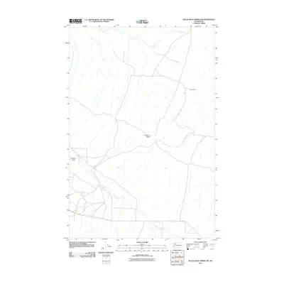
2011 Map of Black Rock Spring NW
USGS Topo · Published 2011About this map
Umtanum Ridge dominates this section of the central Washington landscape, where high-country ranching persists alongside rugged drainage systems. The map captures the agricultural footprint of Yakima County at the turn of the decade, specifically highlighting the Holmes Ranch in the northeast and the Bernhardt Ranch to the west. These family-named holdings are connected by the winding track of Filer Rd, illustrating the sparse but vital infrastructure of the region. Water remains the defining factor for settlement here, with the headwaters and seasonal flows of Lmuma Creek and Selah Creek carving through the arid terrain. The land between these creeks is characterized by significant elevation changes, showing how local ranching operations adapted to the natural contours of the ridge and its surrounding valleys.
Find a feature on this map
6 named features on this map. Tap any name to fly to it.
Don’t see what you’re looking for? This feature index may not catch every label — zoom into the map to look around manually.
Map Details
Editions of this 2011 Black Rock Spring NW Map
This is the sole edition of this map. No revisions or reprints were ever made.
Other maps of this area

1936 · Yakima East
USGS Topo · 1:48,000

1936 · Hog Ranch Buttes
USGS Topo · 1:48,000

1938 · Badger Pocket
USGS Topo · 1:48,000

1939 · Boylston
USGS Topo · 1:48,000

1941 · Black Rock Spring
USGS Topo · 1:62,500

1941 · Yakima East
USGS Topo · 1:62,500

1943 · Boylston
USGS Topo · 1:62,500

1943 · Badger Pocket
USGS Topo · 1:62,500

1950 · Yakima
USGS Topo · 1:250,000

1953 · McDonald Spring
USGS Topo · 1:24,000