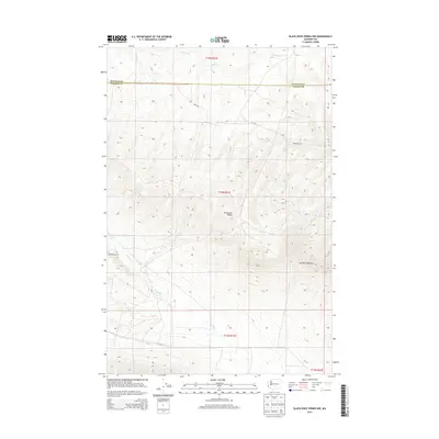
2013 Map of Black Rock Spring NW
USGS Topo · Published 2013About this map
Umtanum Ridge dominates the center of this high-desert landscape along the border of Kittitas and Yakima counties. This 2013 survey reveals a rugged, sparsely populated region characterized by dramatic elevation changes and dry creek beds. Family landmarks like the Holmes Ranch in the northeast and Bernhardt Ranch to the west indicate the persistent agricultural presence in this challenging environment. The map details the drainage patterns of Lmuma Cr and Selah Cr, which carve through the high plateaus. To the southeast, the Hog Ranch Buttes rise as a distinctive landform, while Filey Rd provides the primary transit route through the undulating terrain of the central hills.
Find a feature on this map
12 named features on this map. Tap any name to fly to it.
Don’t see what you’re looking for? This feature index may not catch every label — zoom into the map to look around manually.
Map Details
Editions of this 2013 Black Rock Spring NW Map
This is the sole edition of this map. No revisions or reprints were ever made.
Other maps of this area

1936 · Yakima East
USGS Topo · 1:48,000

1936 · Hog Ranch Buttes
USGS Topo · 1:48,000

1938 · Badger Pocket
USGS Topo · 1:48,000

1939 · Boylston
USGS Topo · 1:48,000

1941 · Black Rock Spring
USGS Topo · 1:62,500

1941 · Yakima East
USGS Topo · 1:62,500

1943 · Boylston
USGS Topo · 1:62,500

1943 · Badger Pocket
USGS Topo · 1:62,500

1950 · Yakima
USGS Topo · 1:250,000

1953 · McDonald Spring
USGS Topo · 1:24,000