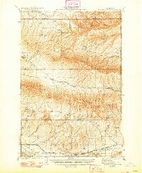
1941 Map of Black Rock Spring
USGS Topo · Published 1948About this map
Umtanum Ridge and the Hog Ranch Buttes dominate this 1930s landscape, illustrating the remote ranching economy and rugged topography of the area between the Kittitas and Yakima county line. The map captures a network of isolated homesteads including the Bernhardt Ranch, Holmes Ranch, and Stewart Ranch, which are linked by primitive roads and seasonal water sources like Black Rock Spr.
Find a feature on this map
24 named features on this map. Tap any name to fly to it.
Don’t see what you’re looking for? This feature index may not catch every label — zoom into the map to look around manually.
Map Details
Editions of this 1941 Black Rock Spring Map
2 editions found
Other maps of this area

1910 · Zillah
USGS Topo · 1:125,000

1912 · Beverly
USGS Topo · 1:62,500

1915 · Prosser
USGS Topo · 1:125,000

1917 · Priest Rapids
USGS Topo · 1:62,500

1917 · Prosser
USGS Topo · 1:125,000

1936 · Yakima East
USGS Topo · 1:48,000

1936 · Hog Ranch Buttes
USGS Topo · 1:48,000

1938 · Badger Pocket
USGS Topo · 1:48,000

1939 · Boylston
USGS Topo · 1:48,000

1941 · Black Rock Spring
USGS Topo · 1:62,500