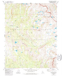
1982 Map of Blackcap Mountain
USGS Topo · Published 1987About this map
Le Conte Divide defines the high-altitude landscape of this Fresno County survey, separating the high basins of the Sierra National Forest from Kings Canyon National Park. The region is a high-Sierra wilderness dominated by glacial features and names that suggest the character of early 20th-century exploration and ranching, such as Schoolmarm Lake, Six Shooter Lake, and Wah Hoo Lake. Human infrastructure is sparse, limited to the Meadow Brook Cabin and a Gaging Station along Meadow Brook, reflecting the area's primary use for scientific monitoring and recreation within the John Muir Wilderness.
Find a feature on this map
68 named features on this map. Tap any name to fly to it.
Don’t see what you’re looking for? This feature index may not catch every label — zoom into the map to look around manually.
Map Details
Editions of this 1982 Blackcap Mountain Map
3 editions found
Other maps of this area

1903 · Tehipite
USGS Topo · 1:125,000

1905 · Tehipite
USGS Topo · 1:125,000

1912 · Mt. Goddard
USGS Topo · 1:125,000

1947 · Mariposa
USGS Topo · 1:250,000

1948 · Fresno
USGS Topo · 1:250,000

1948 · Mariposa
USGS Topo · 1:250,000

1948 · Mt. Goddard
USGS Topo · 1:62,500

1951 · Mt. Goddard
USGS Topo · 1:62,500

1952 · Mt. Goddard
USGS Topo · 1:62,500

1952 · Tehipite Dome
USGS Topo · 1:62,500