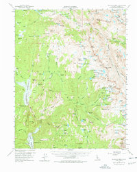
1962 Map of Blackcap Mtn
USGS Topo · Published 1978About this map
Courtright Reservoir and the high alpine basins of the Sierra Nevada define this 1962 landscape in Fresno County. This era captures the region's character as a primitive wilderness managed by the Sierra National Forest and Kings Canyon National Park. The survey details the high-altitude topography where the San Joaquin River and Helms Creek carve through granite peaks, featuring the remote Muir Trail Ranch and segments of the legendary John Muir Trail.
Find a feature on this map
114 named features on this map. Tap any name to fly to it.
Don’t see what you’re looking for? This feature index may not catch every label — zoom into the map to look around manually.
Map Details
Editions of this 1962 Blackcap Mtn Map
2 editions found
Other maps of this area

1903 · Tehipite
USGS Topo · 1:125,000

1904 · Kaiser
USGS Topo · 1:125,000

1905 · Tehipite
USGS Topo · 1:125,000

1912 · Mt. Goddard
USGS Topo · 1:125,000

1922 · Trimmer
USGS Topo · 1:96,000

1924 · Dinuba
USGS Topo · 1:125,000

1947 · Mariposa
USGS Topo · 1:250,000

1948 · Fresno
USGS Topo · 1:250,000

1948 · Mariposa
USGS Topo · 1:250,000

1948 · Mt. Goddard
USGS Topo · 1:62,500