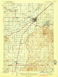
1943 Map of Blackfoot
USGS Topo · Published 1943About this map
The Snake River corridor dominates this 1940s landscape, serving as the vital artery for an extensive network of irrigation that transformed the high desert. Just north of the Fort Hall Indian Reservation boundary, the city of Blackfoot appears as a developed hub featuring the State Hospital and a junction for the Union Pacific Railroad. This survey captures a period of significant agricultural engineering, where dozens of named waterways like the Aberdeen-Springfield Canal and Peoples Canal create a grid of productivity across the flats. South of the river, the terrain shifts abruptly from these irrigated lowlands into the high, uncultivated reaches of Stevens Peak and Buckskin Basin. Notable cultural landmarks of the era include the Indian Agency and Indian School located near Fort Hall, while landmarks like Ferry Butte provide natural navigation points above the river's winding Parsons Slough.
Find a feature on this map
75 named features on this map. Tap any name to fly to it.
Don’t see what you’re looking for? This feature index may not catch every label — zoom into the map to look around manually.
Map Details
Editions of this 1943 Blackfoot Map
2 editions found
Other maps of this area

1934 · Michaud
USGS Topo · 1:62,500

1937 · Pocatello
USGS Topo · 1:48,000

1937 · Michaud
USGS Topo · 1:62,500

1940 · Blackfoot
USGS Topo · 1:62,500

1943 · Blackfoot
USGS Topo · 1:62,500

1944 · Pocatello
USGS Topo · 1:62,500

1954 · Pocatello
USGS Topo · 1:250,000

1955 · Baldy Knoll
USGS Topo · 1:24,000

1955 · Lincoln Creek
USGS Topo · 1:24,000

1955 · Rockford
USGS Topo · 1:24,000