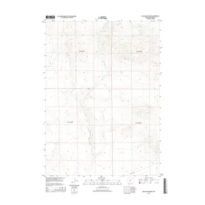
2015 Map of Blackjack Ranch
USGS Topo · Published 2015About this map
Blackjack Ranch stands as a focal point in this high-desert landscape of Natrona County, situated where the terrain begins to rise toward the expansive rim. The topography is defined by the drainage systems of Sage Hen Cr and its tributary, the E Fork Sage Hen Cr, which carve seasonal paths through the arid basins. These watercourses provide the primary geographical structure for the area, dictating the placement of the ranch and the few transit routes available. In the southern portion of the map, Beaver Rim Rd skirts the edge of the prominent escarpment, a critical route for navigating this section of the Wyoming interior. The map illustrates a classic Western ranching environment where life and movement are tied closely to the intermittent water of the creeks and the natural corridors provided by the rimrock geography.
Find a feature on this map
8 named features on this map. Tap any name to fly to it.
Don’t see what you’re looking for? This feature index may not catch every label — zoom into the map to look around manually.
Map Details
Editions of this 2015 Blackjack Ranch Map
This is the sole edition of this map. No revisions or reprints were ever made.
Other maps of this area

1951 · Lone Mountain
USGS Topo · 1:24,000

1951 · Lankin Dome
USGS Topo · 1:24,000

1952 · Ervay Basin SW
USGS Topo · 1:24,000

1952 · Gas Hills
USGS Topo · 1:24,000

1952 · Mc Intosh Meadows
USGS Topo · 1:24,000

1955 · Casper
USGS Topo · 1:250,000

1958 · Casper
USGS Topo · 1:250,000
1958 · Gas Hills
USGS Topo · 1:24,000

1959 · Miller Spring
USGS Topo · 1:24,000

1959 · Blackjack Ranch
USGS Topo · 1:24,000