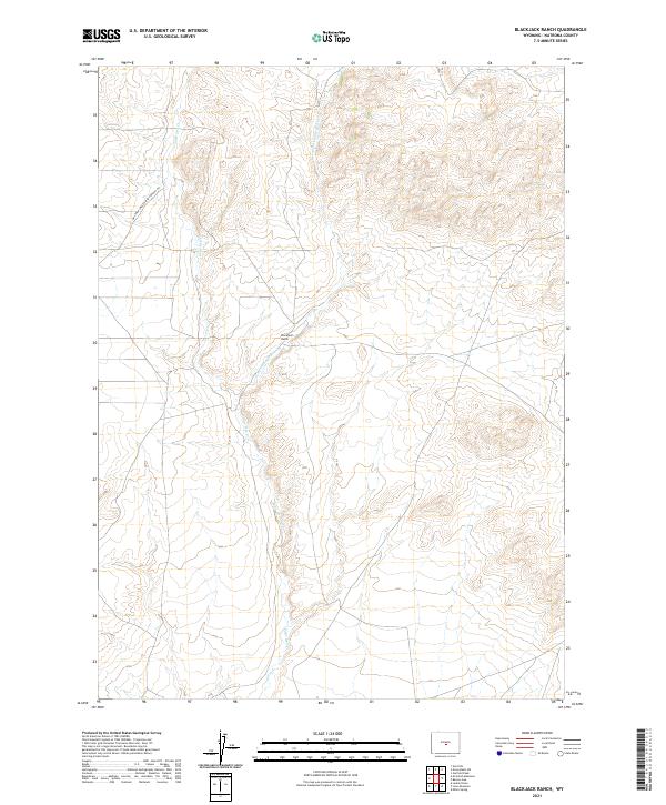
2021 Map of Blackjack Ranch
USGS Topo · Published 2021About this map
Blackjack Ranch sits in the heart of this high-plains landscape, where the drainage systems of Sage Hen Creek and the E Fork Sage Hen Cr shape the terrain. The presence of the Waltman Sweetwater Freight Rd cutting across the northwest corner indicates the enduring importance of historical transport corridors in this part of Natrona County. This survey reflects the sparse, ranch-oriented settlement patterns common in central Wyoming, where geographic features like Sage Hen Cr dictate the layout of land and travel routes. The map provides a precise look at the township and range divisions, including t32n r89w and t31n r88w, offering a clear view of how these remote lands were managed and organized by the turn of the 21st century.
Find a feature on this map
9 named features on this map. Tap any name to fly to it.
Don’t see what you’re looking for? This feature index may not catch every label — zoom into the map to look around manually.
Map Details
Editions of this 2021 Blackjack Ranch Map
This is the sole edition of this map. No revisions or reprints were ever made.
Other maps of this area

1951 · Lone Mountain
USGS Topo · 1:24,000

1951 · Lankin Dome
USGS Topo · 1:24,000

1952 · Ervay Basin SW
USGS Topo · 1:24,000

1952 · Gas Hills
USGS Topo · 1:24,000

1952 · Mc Intosh Meadows
USGS Topo · 1:24,000

1955 · Casper
USGS Topo · 1:250,000

1958 · Casper
USGS Topo · 1:250,000
1958 · Gas Hills
USGS Topo · 1:24,000

1959 · Miller Spring
USGS Topo · 1:24,000

1959 · Blackjack Ranch
USGS Topo · 1:24,000