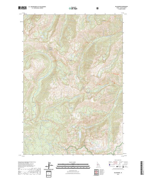
2024 Map of Blackmare
USGS Topo · Published 2024About this map
Miners Peak and Blackmare Summit anchor the high-elevation divide where the Payette National Forest meets the Boise National Forest in this modern topographic study. The landscape is defined by a complex network of glacial cirques and alpine lakes, including Vetes Lake, Cougar Lakes, and Bills Lake, all connected by an extensive system of wilderness trails. The presence of Hot Spring near the center of the quadrangle suggests geothermal activity among the drainages of North Fork Kennally Creek and Blackmare Creek. High-country navigation is traced through established routes like the Needles Summit Trl and Martin Ridge Trl, which follow the narrow ridges between summits. This survey details the modern drainage patterns of the South Fork Buckhorn Creek and the headwaters of the Kennally Creek system, providing a precise view of the topography before any further natural or man-made shifts occur in this protected forest environment.
Find a feature on this map
45 named features on this map. Tap any name to fly to it.
Don’t see what you’re looking for? This feature index may not catch every label — zoom into the map to look around manually.
Map Details
Editions of this 2024 Blackmare Map
This is the sole edition of this map. No revisions or reprints were ever made.
Other maps of this area

1954 · Gold Fork
USGS Topo · 1:62,500

1954 · Warm Lake
USGS Topo · 1:62,500

1957 · Challis
USGS Topo · 1:250,000

1960 · Challis
USGS Topo · 1:250,000

1963 · Challis
USGS Topo · 1:250,000

1973 · Blackmare
USGS Topo · 1:24,000

1973 · White Rock Peak
USGS Topo · 1:24,000

1973 · Fitsum Peak
USGS Topo · 1:24,000
1973 · Paddy Flat
USGS Topo · 1:24,000
1973 · Teapot Mtn
USGS Topo · 1:24,000