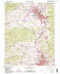
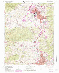
1965 Map of Blacksburg
USGS Topo · Published 1984About this map
Blacksburg and Christiansburg dominate this mid-1960s landscape, illustrating the rapid mid-century development of Montgomery County. The campus of Virginia Polytechnic Institute and State University is a central focal point, featuring Lane Stadium and the VPI Airport alongside the sprawling Prices Fork Research Center. This era shows a transition from agrarian roots to a regional educational and research hub, yet many traditional landmarks remain visible.
Find a feature on this map
95 named features on this map. Tap any name to fly to it.
Don’t see what you’re looking for? This feature index may not catch every label — zoom into the map to look around manually.
Map Details
Editions of this 1965 Blacksburg Map
5 editions found
Other maps of this area

1890 · Dublin
USGS Topo · 1:125,000

1890 · Christiansburg
USGS Topo · 1:125,000

1891 · Dublin
USGS Topo · 1:125,000

1923 · Pearisburg
USGS Topo · 1:62,500

1923 · Waiteville
USGS Topo · 1:62,500

1931 · Waiteville
USGS Topo · 1:48,000

1932 · Pearisburg
USGS Topo · 1:48,000

1932 · Blacksburg
USGS Topo · 1:48,000

1937 · Pearisburg
USGS Topo · 1:62,500

1937 · Blacksburg
USGS Topo · 1:62,500