
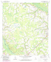
1971 Map of Blackshear West
USGS Topo · Published 1974About this map
Rural Pierce County at the dawn of the 1970s is characterized by a landscape of scattered agricultural clearings, meandering waterways, and deep-rooted community landmarks. The Seaboard Coast Line railroad cuts diagonally across the southeastern terrain, serving as a primary corridor near the settlement of Homestead and the western edge of Blackshear. The hydrological network is defined by the Alabaha River and the Satilla River, with Hacklebarney Creek and Kettle Creek feeding the local drainage system. Local social life is centered around numerous country churches and family-named sites, including Alabama Ch, Piney Grove Ch, and the distinctively named Jot 'Em Down Store. Sand extraction points like the various Sandpit and Sandpits locations indicate the small-scale industrial use of the sandy coastal plain soil during this era.
Find a feature on this map
24 named features on this map. Tap any name to fly to it.
Don’t see what you’re looking for? This feature index may not catch every label — zoom into the map to look around manually.
Map Details
Editions of this 1971 Blackshear West Map
2 editions found
Other maps of this area

1953 · Waycross
USGS Topo · 1:250,000

1958 · Waycross
USGS Topo · 1:250,000

1967 · Hoboken West
USGS Topo · 1:24,000

1967 · Waycross West
USGS Topo · 1:24,000

1967 · Waycross East
USGS Topo · 1:24,000

1971 · Dixie Union
USGS Topo · 1:24,000

1971 · Blackshear East
USGS Topo · 1:24,000

1971 · Patterson
USGS Topo · 1:24,000

1971 · Mershon
USGS Topo · 1:24,000
1971 · Crawley
USGS Topo · 1:24,000