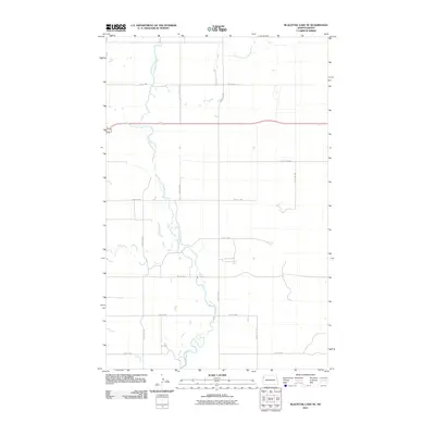
2011 Map of Blacktail Lake SE
USGS Topo · Published 2011About this map
The Little Muddy River meanders through this agricultural landscape in Williams County, joined by the East Fork Little Muddy River in the north and fed by Otter Tail Creek and Cow Creek. The terrain is defined by a systematic grid of section roads, including 65th St NW and 58th St NW, which facilitate movement across this sparsely settled corner of North Dakota. Modern infrastructure is represented by County Hwy-8B, cutting a straight east-west path through the river valley. This survey illustrates the relationship between the natural drainage system of the Missouri River watershed and the rigid township and range road network that structures the region's rural character.
Find a feature on this map
16 named features on this map. Tap any name to fly to it.
Don’t see what you’re looking for? This feature index may not catch every label — zoom into the map to look around manually.
Map Details
Editions of this 2011 Blacktail Lake SE Map
This is the sole edition of this map. No revisions or reprints were ever made.
Other maps of this area

1911 · Ray
USGS Topo · 1:125,000

1953 · Williston
USGS Topo · 1:250,000

1957 · Williston
USGS Topo · 1:250,000

1959 · Marmon SE
USGS Topo · 1:24,000

1959 · Williston West
USGS Topo · 1:24,000

1959 · Williston East
USGS Topo · 1:24,000

1974 · Blacktail Lake
USGS Topo · 1:24,000

1974 · Otter Tail Creek
USGS Topo · 1:24,000

1974 · Twin Lakes
USGS Topo · 1:24,000

1978 · Epping NW
USGS Topo · 1:24,000