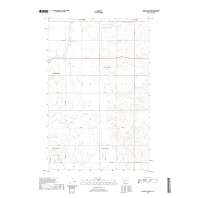
2020 Map of Blacktail Lake SE
USGS Topo · Published 2020About this map
Little Muddy River winds through this section of Williams County, defining a landscape shaped by the drainage patterns of the Missouri River plateau. At this time in 2020, the area shows a clear transition from the expansive agricultural sections to the north and south towards more concentrated rural residential development in the southwest corner. Local travel is defined by a grid of section-line roads such as 64th St NW and Co Hwy 9, which connect isolated homesteads to the regional network. Tributaries like E Fork Little Muddy River and Cow Cr carve subtle valleys into the high plains, providing critical landmarks for local land navigation. The map captures the organized layout of the Public Land Survey System, with township and range lines like t156n r100w governing the distribution of property and access routes.
Find a feature on this map
31 named features on this map. Tap any name to fly to it.
Don’t see what you’re looking for? This feature index may not catch every label — zoom into the map to look around manually.
Map Details
Editions of this 2020 Blacktail Lake SE Map
This is the sole edition of this map. No revisions or reprints were ever made.
Other maps of this area

1911 · Ray
USGS Topo · 1:125,000

1953 · Williston
USGS Topo · 1:250,000

1957 · Williston
USGS Topo · 1:250,000

1959 · Marmon SE
USGS Topo · 1:24,000

1959 · Williston West
USGS Topo · 1:24,000

1959 · Williston East
USGS Topo · 1:24,000

1974 · Blacktail Lake
USGS Topo · 1:24,000

1974 · Otter Tail Creek
USGS Topo · 1:24,000

1974 · Twin Lakes
USGS Topo · 1:24,000

1978 · Epping NW
USGS Topo · 1:24,000