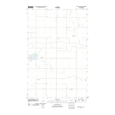
2011 Map of Blacktail Lake
USGS Topo · Published 2011About this map
Blacktail Lake serves as a central landmark in this Williams County landscape, formed behind the Blacktail Dam along the course of Blacktail Creek. The surrounding terrain is defined by a grid of agricultural section lines and rural routes like County Hwy-3 that connect isolated landmarks. Near the southern edge, the settlement of Marmon provides a focal point for the surrounding prairie community, situated just north of where Otter Tail Creek meanders toward the section borders.
Find a feature on this map
27 named features on this map. Tap any name to fly to it.
Don’t see what you’re looking for? This feature index may not catch every label — zoom into the map to look around manually.
Map Details
Editions of this 2011 Blacktail Lake Map
This is the sole edition of this map. No revisions or reprints were ever made.
Other maps of this area

1948 · Hanks
USGS Topo · 1:24,000

1948 · Zahl
USGS Topo · 1:24,000

1953 · Williston
USGS Topo · 1:250,000

1957 · Williston
USGS Topo · 1:250,000

1959 · Marmon SE
USGS Topo · 1:24,000

1974 · Blacktail Lake
USGS Topo · 1:24,000

1974 · Bonetraill
USGS Topo · 1:24,000

1974 · Otter Tail Creek
USGS Topo · 1:24,000

1974 · Twin Lakes
USGS Topo · 1:24,000
1974 · Bonetraill SE
USGS Topo · 1:24,000