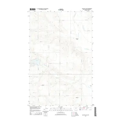
2014 Map of Blacktail Lake
USGS Topo · Published 2014About this map
Marmon serves as a central reference point in this landscape of northwestern North Dakota, where the prairie is defined by its seasonal drainages and topographic depressions. The hydrography of Williams County is well-documented here, including the waters of Blacktail Lake and the meandering course of the Little Muddy River. A network of section-line roads, such as 139th Ave NW and 69th St NW, imposes a geometric order over the undulating terrain. Family history and local heritage are anchored by small, rural landmarks like the Bethel Cem and Faith Cem, which stand near Blacktail Cr. The map also captures several coulees and creeks, including Heidemann Coulee and Otter Tail Cr, illustrating the natural drainage patterns that have influenced settlement and land use since the homesteading era.
Find a feature on this map
22 named features on this map. Tap any name to fly to it.
Don’t see what you’re looking for? This feature index may not catch every label — zoom into the map to look around manually.
Map Details
Editions of this 2014 Blacktail Lake Map
This is the sole edition of this map. No revisions or reprints were ever made.
Other maps of this area

1948 · Hanks
USGS Topo · 1:24,000

1948 · Zahl
USGS Topo · 1:24,000

1953 · Williston
USGS Topo · 1:250,000

1957 · Williston
USGS Topo · 1:250,000

1959 · Marmon SE
USGS Topo · 1:24,000

1974 · Blacktail Lake
USGS Topo · 1:24,000

1974 · Bonetraill
USGS Topo · 1:24,000

1974 · Otter Tail Creek
USGS Topo · 1:24,000

1974 · Twin Lakes
USGS Topo · 1:24,000
1974 · Bonetraill SE
USGS Topo · 1:24,000