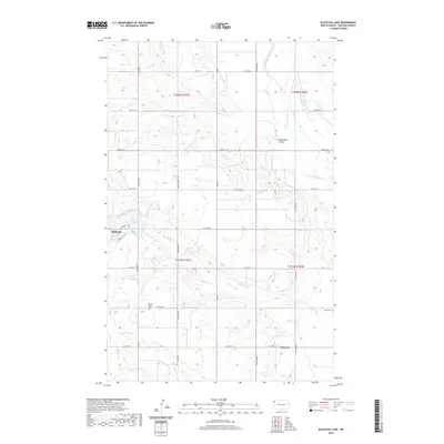
2020 Map of Blacktail Lake
USGS Topo · Published 2020About this map
Blacktail Lake serves as a central landmark in this portion of Williams County, where the high plains terrain is carved by the Little Muddy River and its various tributaries. The settlement of Blacktail sits on the western shore of the lake, while the small community of Marmon is located further southeast. This 2020 survey reveals a landscape largely defined by its rural road network and water drainage patterns, including Heidemann Coulee and Blacktail Cr. For genealogists and local historians, the map provides precise locations for the Bethel Lutheran Cem and Faith Cem, which serve as lasting markers of the area's pioneer heritage. The Public Land Survey System grid remains the primary organizing force for the region's development, with township lines like t158n r101w delineating the agricultural and residential tracts.
Find a feature on this map
32 named features on this map. Tap any name to fly to it.
Don’t see what you’re looking for? This feature index may not catch every label — zoom into the map to look around manually.
Map Details
Editions of this 2020 Blacktail Lake Map
This is the sole edition of this map. No revisions or reprints were ever made.
Other maps of this area

1948 · Hanks
USGS Topo · 1:24,000

1948 · Zahl
USGS Topo · 1:24,000

1953 · Williston
USGS Topo · 1:250,000

1957 · Williston
USGS Topo · 1:250,000

1959 · Marmon SE
USGS Topo · 1:24,000

1974 · Blacktail Lake
USGS Topo · 1:24,000

1974 · Bonetraill
USGS Topo · 1:24,000

1974 · Otter Tail Creek
USGS Topo · 1:24,000

1974 · Twin Lakes
USGS Topo · 1:24,000
1974 · Bonetraill SE
USGS Topo · 1:24,000