
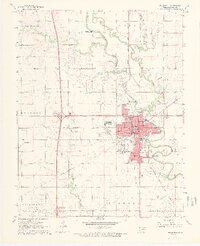
1968 Map of Blackwell
USGS Topo · Published 1970About this map
The Chikaskia River winds past the developed center of Blackwell in this late 1960s study of Kay County. The landscape is defined by the intersection of traditional rail lines, such as the Atchison Topeka and Santa Fe, and the modern transportation network, including the newly established Highway 11 Interchange. Industrial activity is evident throughout the region, with the expansive Blackwell Oil and Gas Field and several gravel pits marking the outskirts of the city.
Find a feature on this map
44 named features on this map. Tap any name to fly to it.
Don’t see what you’re looking for? This feature index may not catch every label — zoom into the map to look around manually.
Map Details
Editions of this 1968 Blackwell Map
2 editions found
Other maps of this area

1955 · Enid
USGS Topo · 1:250,000

1958 · Enid
USGS Topo · 1:250,000

1967 · Braman
USGS Topo · 1:24,000

1968 · Ponca City NW
USGS Topo · 1:24,000

1968 · Eddy
USGS Topo · 1:24,000

1968 · Blackwell NW
USGS Topo · 1:24,000

1968 · Nardin
USGS Topo · 1:24,000

1968 · Tonkawa
USGS Topo · 1:24,000
1968 · Newkirk SW
USGS Topo · 1:24,000
1968 · Peckham
USGS Topo · 1:24,000