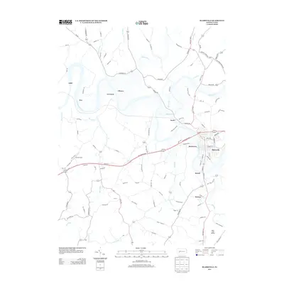
2013 Map of Blairsville
USGS Topo · Published 2013About this map
The Conemaugh River carves a deep horseshoe bend known as the Bow as it winds through this portion of Indiana County. The river and its tributaries, including Blacklick Cr and Aultmans Run, dictate the orientation of small settlements and transportation corridors. The primary population center at Blairsville sits along the eastern bank, connected to neighboring Bairdstown across the water.
Find a feature on this map
110 named features on this map. Tap any name to fly to it.
Don’t see what you’re looking for? This feature index may not catch every label — zoom into the map to look around manually.
Map Details
Editions of this 2013 Blairsville Map
This is the sole edition of this map. No revisions or reprints were ever made.
Other maps of this area

1900 · Latrobe
USGS Topo · 1:62,500

1902 · Latrobe
USGS Topo · 1:62,500

1902 · Indiana
USGS Topo · 1:62,500

1902 · Elders Ridge
USGS Topo · 1:62,500

1903 · Latrobe
USGS Topo · 1:62,500

1904 · Elders Ridge
USGS Topo · 1:62,500

1920 · New Florence
USGS Topo · 1:62,500

1921 · New Florence
USGS Topo · 1:48,000

1922 · New Florence
USGS Topo · 1:62,500

1944 · New Florence
USGS Topo · 1:62,500
Featured Places
- Blairsville, PA
- Black Lick Township, PA
- Burrell Township, PA
- Derry Township, PA
- Fillmore, Black Lick Township