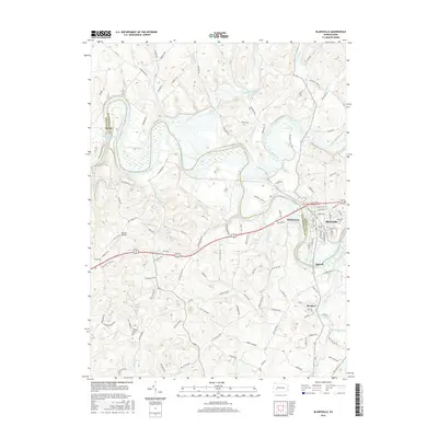
2016 Map of Blairsville
USGS Topo · Published 2016About this map
Blairsville and Bairdstown anchor this 2016 survey along the banks of the Conemaugh River, where the borders of Indiana and Westmoreland counties meet. The landscape is defined by the significant flow of Blacklick Creek and the expansive Conemaugh River Lake, which dominate the central terrain. Transportation history is visible in the Old Railroad Grade tracing the river's western bank, while modern infrastructure is represented by the Dunlea Airpark and a network of named country roads like Livermore Rd and Old Rte 22. Local genealogy and community landmarks are prominent, including Blairsville Cem on the town's eastern edge and the Mount Carmel Cem further south. The map also documents smaller settlements such as Brenizer and Burrell, providing a clear view of the rural and industrial intersections that define this portion of the Laurel Highlands region.
Find a feature on this map
112 named features on this map. Tap any name to fly to it.
Don’t see what you’re looking for? This feature index may not catch every label — zoom into the map to look around manually.
Map Details
Editions of this 2016 Blairsville Map
This is the sole edition of this map. No revisions or reprints were ever made.
Other maps of this area

1900 · Latrobe
USGS Topo · 1:62,500

1902 · Latrobe
USGS Topo · 1:62,500

1902 · Indiana
USGS Topo · 1:62,500

1902 · Elders Ridge
USGS Topo · 1:62,500

1903 · Latrobe
USGS Topo · 1:62,500

1904 · Elders Ridge
USGS Topo · 1:62,500

1920 · New Florence
USGS Topo · 1:62,500

1921 · New Florence
USGS Topo · 1:48,000

1922 · New Florence
USGS Topo · 1:62,500

1944 · New Florence
USGS Topo · 1:62,500
Featured Places
- Blairsville, PA
- Black Lick Township, PA
- Burrell Township, PA
- Derry Township, PA
- Fillmore, Black Lick Township