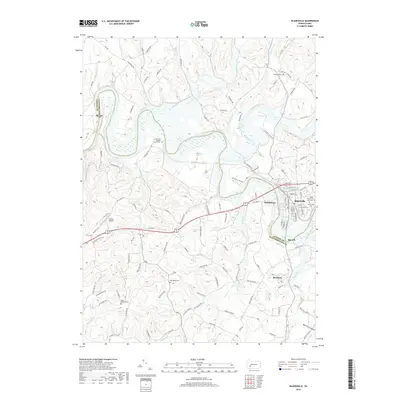
2019 Map of Blairsville
USGS Topo · Published 2019About this map
Blairsville stands at the eastern edge of this modern survey, where the Conemaugh River forms a sharp boundary between Indiana and Westmoreland counties. The area is characterized by a transition from the urban grid of the borough to the outlying agricultural and wooded landscapes of Burrell and Bairdstown. Transport corridors like Old Rte 22 and Industrial Park Rd reflect contemporary infrastructure, yet the landscape remains anchored by several historical resting places. These include the Livermore Baptist Church Cem near the river and the Old Salem Cem further south. To the north, the confluence of Blacklick Creek and the river defines the local topography, while small landmarks like the Dunlea Airpark and settlements such as Brenizer indicate the varied uses of the land outside the main population centers.
Find a feature on this map
111 named features on this map. Tap any name to fly to it.
Don’t see what you’re looking for? This feature index may not catch every label — zoom into the map to look around manually.
Map Details
Editions of this 2019 Blairsville Map
This is the sole edition of this map. No revisions or reprints were ever made.
Other maps of this area

1900 · Latrobe
USGS Topo · 1:62,500

1902 · Latrobe
USGS Topo · 1:62,500

1902 · Indiana
USGS Topo · 1:62,500

1902 · Elders Ridge
USGS Topo · 1:62,500

1903 · Latrobe
USGS Topo · 1:62,500

1904 · Elders Ridge
USGS Topo · 1:62,500

1920 · New Florence
USGS Topo · 1:62,500

1921 · New Florence
USGS Topo · 1:48,000

1922 · New Florence
USGS Topo · 1:62,500

1944 · New Florence
USGS Topo · 1:62,500
Featured Places
- Blairsville, PA
- Black Lick Township, PA
- Burrell Township, PA
- Derry Township, PA
- Fillmore, Black Lick Township