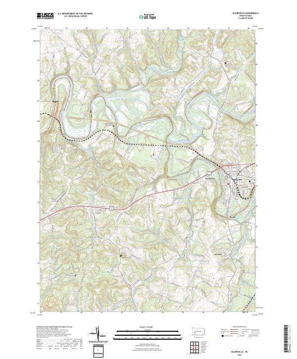
2023 Map of Blairsville
USGS Topo · Published 2023About this map
The Conemaugh River and Blacklick Creek converge at the boundary of Indiana Co and Westmoreland Co, shaping a landscape defined by water and early transportation routes. Centered on Blairsville, this study shows the town's grid and its relationship to the Blairsville Riverfront Trl and the Kiski-Conemaugh River Water Trl. The map is particularly useful for genealogical research, documenting several distinct burial grounds including Saints Simon and Jude Cem, the large Blairsville Cem, and rural locations like the Livermore Baptist Church Cem and Old Salem Cem. Smaller settlements such as Bairdstown, Burrell, and Brenizer appear along the river and rail corridors. The surrounding hills are marked by family-named routes and landmarks like Bear Cave Hollow and Dunlea Airpark, reflecting the region's mix of residential, industrial, and recreational uses near the river bends.
Find a feature on this map
124 named features on this map. Tap any name to fly to it.
Don’t see what you’re looking for? This feature index may not catch every label — zoom into the map to look around manually.
Map Details
Editions of this 2023 Blairsville Map
This is the sole edition of this map. No revisions or reprints were ever made.
Other maps of this area

1900 · Latrobe
USGS Topo · 1:62,500

1902 · Latrobe
USGS Topo · 1:62,500

1902 · Indiana
USGS Topo · 1:62,500

1902 · Elders Ridge
USGS Topo · 1:62,500

1903 · Latrobe
USGS Topo · 1:62,500

1904 · Elders Ridge
USGS Topo · 1:62,500

1920 · New Florence
USGS Topo · 1:62,500

1921 · New Florence
USGS Topo · 1:48,000

1922 · New Florence
USGS Topo · 1:62,500

1944 · New Florence
USGS Topo · 1:62,500