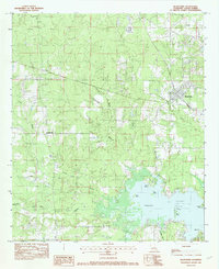
1982 Map of Blanchard
USGS Topo · Published 1982About this map
Blanchard and the surrounding Caddo Parish landscape are defined by a complex network of waterways feeding into the northern reaches of Cross Lake. The 1982 topography reveals the intricate drainage patterns of Piney Bayou, Shettleworth Bayou, and Republican Bayou, which meander through the terrain toward the lake's edge. The shoreline itself is marked by distinctive features such as Squirrel Point and Moss Point, while several landmasses including Pine Island and Gum Island rise above the water level. This era shows the Shreveport city limits following the jagged northern shore of the lake, juxtaposing the growing urban reach with the rural settlements of Longwood and Shipp. The map detail captures the intersection of natural bayous and human developments like pipelines and local roads that shaped this region of Louisiana in the early 1980s.
Find a feature on this map
16 named features on this map. Tap any name to fly to it.
Don’t see what you’re looking for? This feature index may not catch every label — zoom into the map to look around manually.
Map Details
Editions of this 1982 Blanchard Map
2 editions found
Other maps of this area

1932 · Shreveport SE
USGS Topo · 1:31,680

1932 · Shreveport NE
USGS Topo · 1:31,680

1943 · Waskom
USGS Topo · 1:62,500

1944 · Caddo Lake
USGS Topo · 1:62,500

1945 · Waskom
USGS Topo · 1:62,500

1945 · Greenwood
USGS Topo · 1:62,500

1946 · Caddo Lake
USGS Topo · 1:62,500

1948 · Mooringsport
USGS Topo · 1:62,500

1955 · Shreveport
USGS Topo · 1:250,000
1955 · North Shreveport
USGS Topo · 1:24,000