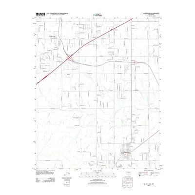
2012 Map of Blanchard
USGS Topo · Published 2012About this map
The growing community of Blanchard anchors the southern portion of this McClain County landscape, situated where the local road network converges near Blanchard Cem. To the northwest, the settlement of Bridge Creek marks a distinct cluster of residential development, reflecting the suburban expansion characteristic of the early 21st century in Central Oklahoma. The terrain is defined by a dense dendritic drainage system, with the N Fork Walnut Cr and its various tributaries, such as Bridge Cr and Stinson Cr, carving through the plains. This 2012 survey illustrates the transition from rural agricultural plots to more structured residential blocks and cul-de-sacs. Significant infrastructure includes the Warbonnet Airport, which serves as a notable landmark amidst the sprawling network of county roads like N2950 Rd and S Mustang Rd.
Find a feature on this map
169 named features on this map. Tap any name to fly to it.
Don’t see what you’re looking for? This feature index may not catch every label — zoom into the map to look around manually.
Map Details
Editions of this 2012 Blanchard Map
This is the sole edition of this map. No revisions or reprints were ever made.
Other maps of this area

1893 · Oklahoma City
USGS Topo · 1:62,500

1893 · Minco
USGS Topo · 1:62,500

1904 · Chickasha
USGS Topo · 1:125,000

1954 · Oklahoma City
USGS Topo · 1:250,000

1956 · Oklahoma City
USGS Topo · 1:62,500

1956 · Oklahoma City SE
USGS Topo · 1:24,000

1957 · Oklahoma City
USGS Topo · 1:250,000

1963 · Oklahoma City
USGS Topo · 1:250,000
1965 · Newcastle
USGS Topo · 1:24,000
1965 · Cole
USGS Topo · 1:24,000