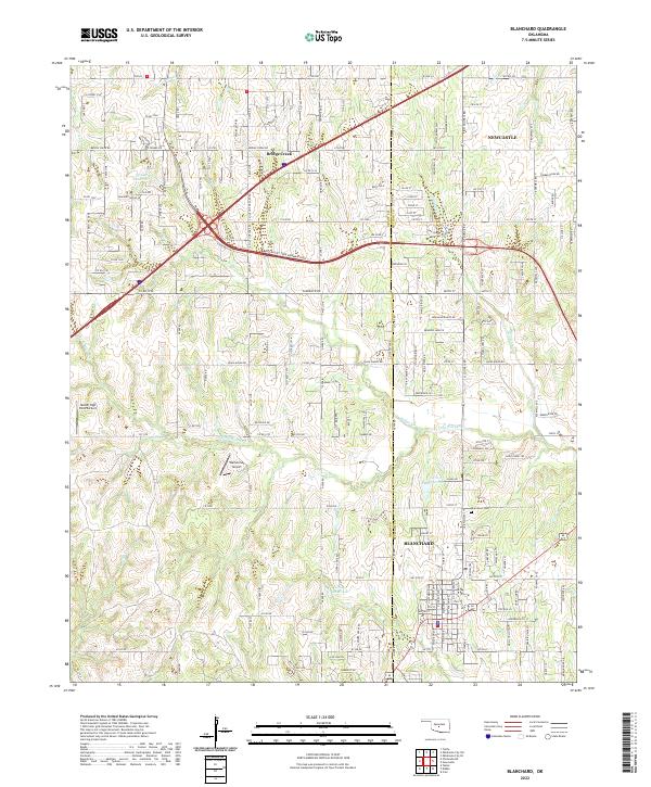
2022 Map of Blanchard
USGS Topo · Published 2022About this map
Blanchard occupies the southeastern corner of this landscape, situated along the county line where Grady and McClain counties meet. This 2022 survey illustrates the suburban expansion and modern transportation network of the Oklahoma City metropolitan fringe, dominated by the H E Bailey Tpke Norman Spur and an intricate grid of rural-residential roads like Bridge Creek Rd. The terrain is defined by the drainage basins of the N Fork Walnut Cr and Stinson Cr, which wind through rolling topography punctuated by private aviation facilities such as Nelson High Point Airport and Warbonnet Airport.
Find a feature on this map
91 named features on this map. Tap any name to fly to it.
Don’t see what you’re looking for? This feature index may not catch every label — zoom into the map to look around manually.
Map Details
Editions of this 2022 Blanchard Map
This is the sole edition of this map. No revisions or reprints were ever made.
Other maps of this area

1893 · Oklahoma City
USGS Topo · 1:62,500

1893 · Minco
USGS Topo · 1:62,500

1904 · Chickasha
USGS Topo · 1:125,000

1954 · Oklahoma City
USGS Topo · 1:250,000

1956 · Oklahoma City
USGS Topo · 1:62,500

1956 · Oklahoma City SE
USGS Topo · 1:24,000

1957 · Oklahoma City
USGS Topo · 1:250,000

1963 · Oklahoma City
USGS Topo · 1:250,000
1965 · Newcastle
USGS Topo · 1:24,000
1965 · Cole
USGS Topo · 1:24,000