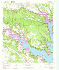
1958 Map of Bland
USGS Topo · Published 1979About this map
The Fort Hood Military Reservation dominates this central Texas landscape, where the rugged topography of the Owl Mountains meets the artificial shoreline of Belton Lake. Surveyed in 1958 with updates through the late 1970s, the map captures a transition as former ranch lands and settlements were absorbed into the military's footprint. The boundary line between Coryell and Bell counties bisects the north, cutting through the headwaters of Owl Creek and Bear Creek.
Find a feature on this map
21 named features on this map. Tap any name to fly to it.
Don’t see what you’re looking for? This feature index may not catch every label — zoom into the map to look around manually.
Map Details
Editions of this 1958 Bland Map
Other maps of this area

1892 · Temple
USGS Topo · 1:125,000

1894 · Gatesville
USGS Topo · 1:125,000

1924 · Gatesville 4-d
USGS Topo · 1:48,000

1924 · Gatesville 4-a
USGS Topo · 1:48,000

1924 · Temple 2-C
USGS Topo · 1:48,000

1924 · Temple 3-C
USGS Topo · 1:48,000

1924 · Temple 3-B
USGS Topo · 1:48,000

1930 · Killeen
USGS Topo · 1:62,500

1931 · Mc Gregor
USGS Topo · 1:62,500

1931 · Belton
USGS Topo · 1:62,500