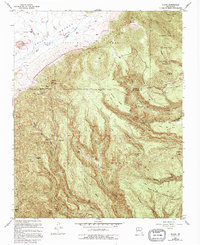
1953 Map of Bland
USGS Topo · Published 1995About this map
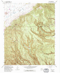
Pines (Ghost town) sits at the heart of this high-altitude landscape, where the jagged topography of the San Miguel Mountains meets the deep incisions of Cochiti Canyon and Medio Dia Canyon. The 1993 revisions highlight a history of extraction and isolation, marking the Cochiti Mining District and the Valla Grande Pumice Mine alongside a series of formerly inhabited sites. This territory is a complex mosaic of land management and ancestral boundaries, spanning the Baca Location No 1, Santa Fe National Forest, and the rugged eastern edge of the Bandelier National Monument. Evidence of old homesteads and mining claims are found at the Evans-Griffin Place, Bruce Place, and the Washington Group, providing a clear record of 20th-century habitation and industry that has since receded into the volcanic mesas.
Find a feature on this map
62 named features on this map. Tap any name to fly to it.
Don’t see what you’re looking for? This feature index may not catch every label — zoom into the map to look around manually.
Map Details
Editions of this 1953 Bland Map
6 editions found

Other maps of this area

1890 · Jemes
USGS Topo · 1:125,000

1892 · Jemes
USGS Topo · 1:125,000

1892 · Santa Clara
USGS Topo · 1:125,000

1937 · Jemez Springs
USGS Topo · 1:48,000

1943 · Jemez
USGS Topo · 1:62,500

1944 · Jemez Springs
USGS Topo · 1:62,500

1952 · Valle Toledo
USGS Topo · 1:24,000

1952 · Jemez Springs
USGS Topo · 1:62,500

1952 · Frijoles
USGS Topo · 1:24,000

1952 · Guaje Mountain
USGS Topo · 1:24,000