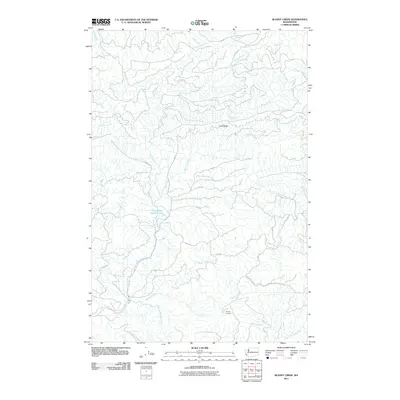
2011 Map of Blaney Creek
USGS Topo · Published 2011About this map
The Grays River and its complex network of tributaries dominate this Pacific County landscape, reflecting the heavy-timber and watershed geography of the region. This 2011 map reveals a terrain heavily shaped by forestry and conservation, notably marked by the Grays River Salmon Pond and the Blaney Lookout perched near the headwaters of Blaney Creek. The drainage patterns are intricate, with the East Fork Grays River and South Fork Grays River converging among a dense web of unnamed forestry roads, such as 7000 Rd and 7200 Rd. To the north, the elevation rises toward Long Ridge, where the waters divide between the Grays system and the Willapa River basin via Crim Creek and Falls Creek. This map is an essential reference for understanding the modern hydraulic and industrial footprint in this specific corner of the Pacific Northwest.
Find a feature on this map
31 named features on this map. Tap any name to fly to it.
Don’t see what you’re looking for? This feature index may not catch every label — zoom into the map to look around manually.
Map Details
Editions of this 2011 Blaney Creek Map
This is the sole edition of this map. No revisions or reprints were ever made.
Other maps of this area

1940 · Brookfield
USGS Topo · 1:62,500

1941 · Walville
USGS Topo · 1:62,500

1941 · Skamokawa
USGS Topo · 1:62,500

1953 · Hoquiam
USGS Topo · 1:250,000

1953 · Skamokawa
USGS Topo · 1:62,500

1953 · Pe Ell
USGS Topo · 1:62,500

1955 · Grays River
USGS Topo · 1:62,500

1955 · Raymond
USGS Topo · 1:62,500

1957 · Hoquiam
USGS Topo · 1:250,000

1958 · Hoquiam
USGS Topo · 1:250,000