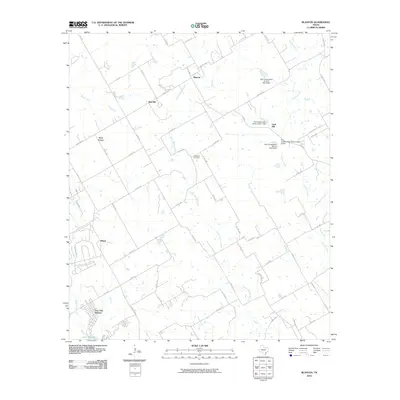
2010 Map of Blanton
USGS Topo · Published 2010About this map
Jawbone Cemetery stands near the center of this Hill County landscape, situated along the divide between Little Aquilla Creek and Rock Creek. The map shows a transition from the agricultural uplands near Blanton and Red Hill toward the recreational shoreline of Lake Whitney in the southwest corner. The settlement of Huron anchors the southern portion of the sheet, while the northern reaches are defined by a network of county roads like Co RD 1143 and small-scale water management projects, including Soil Conservation Service Site 6 Dam. The terrain is marked by distinct rises such as Grub Hill and West Prairie, reflecting the localized topography of the Brazos River basin. Modern infrastructure, particularly the Live Oak Resorts, highlights the area's development as a destination for outdoor recreation during this period.
Find a feature on this map
62 named features on this map. Tap any name to fly to it.
Don’t see what you’re looking for? This feature index may not catch every label — zoom into the map to look around manually.
Map Details
Editions of this 2010 Blanton Map
This is the sole edition of this map. No revisions or reprints were ever made.
Other maps of this area

1891 · Cleburne
USGS Topo · 1:125,000

1892 · Waco
USGS Topo · 1:125,000

1894 · Cleburne
USGS Topo · 1:125,000

1920 · Waco
USGS Topo · 1:125,000

1924 · Cleburne 3-B
USGS Topo · 1:48,000

1924 · Waco 2-b
USGS Topo · 1:48,000

1924 · Cleburne 3-C
USGS Topo · 1:48,000

1927 · Blum
USGS Topo · 1:62,500

1931 · Whitney
USGS Topo · 1:62,500

1954 · Dallas
USGS Topo · 1:250,000