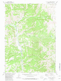
1980 Map of Blind Bull Creek
USGS Topo · Published 1980About this map
Bridger National Forest dominates this Wyoming landscape, where the Greys River snakes through the valley floor at a distinctive bend known as The Elbow. Resource extraction and mountain transit define the area's human footprint, evidenced by the high-elevation Vail Mine and Blind Bull Mine near the eastern boundary. The presence of the Box Y Ranch and a remote Guard Station along the river suggest a seasonal or ranching-focused settlement pattern typical of the mid-20th century forest service era. A dense network of paths, including the Pack Trail and numerous unnamed trails, follows drainage lines like Deadman Creek and Moffat Creek. This complex geography of ridges and hollows, such as Middle Ridge and Telephone Hollow, illustrates the rugged difficulty of managing timber and mineral claims in this part of Lincoln County.
Find a feature on this map
31 named features on this map. Tap any name to fly to it.
Don’t see what you’re looking for? This feature index may not catch every label — zoom into the map to look around manually.
Map Details
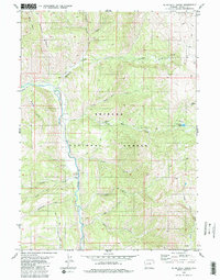
Editions of this 1980 Blind Bull Creek Map
2 editions found
Other maps of this area

1921 · Afton
USGS Topo · 1:125,000

1931 · Jackson
USGS Topo · 1:125,000

1935 · Jackson
USGS Topo · 1:125,000

1955 · Driggs
USGS Topo · 1:250,000

1955 · Preston
USGS Topo · 1:250,000

1958 · Driggs
USGS Topo · 1:250,000

1958 · Preston
USGS Topo · 1:250,000

1962 · Driggs
USGS Topo · 1:250,000

1962 · Preston
USGS Topo · 1:250,000

1965 · Pickle Pass
USGS Topo · 1:24,000