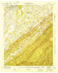
1942 Map of Blockhouse
USGS Topo · Published 1942About this map
Montvale Springs and the rural outskirts of Maryville anchor this 1941 Tennessee Valley Authority and Geological Survey examination. The landscape transitions from the valley floors of Pistol Creek and Brown Branch into the steep ridgelines of the Great Smoky Mountains. A dense network of community landmarks defines the social geography of the era, including Laws Chapel Sch, Chilhowee View Sch, and Sixmile Sch.
Find a feature on this map
64 named features on this map. Tap any name to fly to it.
Don’t see what you’re looking for? This feature index may not catch every label — zoom into the map to look around manually.
Map Details
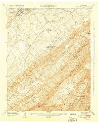
Editions of this 1942 Blockhouse Map
2 editions found
Other maps of this area

1886 · Knoxville
USGS Topo · 1:125,000

1892 · Knoxville
USGS Topo · 1:125,000

1894 · Knoxville
USGS Topo · 1:125,000

1895 · Loudon
USGS Topo · 1:125,000

1895 · Knoxville
USGS Topo · 1:125,000

1901 · Knoxville
USGS Topo · 1:125,000

1935 · Binfield
USGS Topo · 1:24,000

1935 · Knoxville
USGS Topo · 1:48,000

1935 · Maryville
USGS Topo · 1:24,000

1935 · Wildwood
USGS Topo · 1:24,000