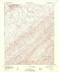
1953 Map of Blockhouse
USGS Topo · Published 1955About this map
Montvale Springs and the surrounding Blount County foothills are documented here in the early 1950s, showing a landscape defined by small mountain communities and rural institutions. The map reveals a dense network of country schools and churches, including the Sam Houston School near the southern edge of Maryville and the Chilhowee View School further south. The settlement of Blockhouse serves as a central point between the rising slopes of Pea Ridge and Chilhowee Mountain.
Find a feature on this map
65 named features on this map. Tap any name to fly to it.
Don’t see what you’re looking for? This feature index may not catch every label — zoom into the map to look around manually.
Map Details
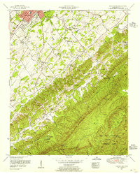
Editions of this 1953 Blockhouse Map
2 editions found
Other maps of this area

1886 · Knoxville
USGS Topo · 1:125,000

1892 · Knoxville
USGS Topo · 1:125,000

1894 · Knoxville
USGS Topo · 1:125,000

1895 · Loudon
USGS Topo · 1:125,000

1895 · Knoxville
USGS Topo · 1:125,000

1901 · Knoxville
USGS Topo · 1:125,000

1935 · Binfield
USGS Topo · 1:24,000

1935 · Knoxville
USGS Topo · 1:48,000
1935 · Maryville
USGS Topo · 1:24,000
1935 · Wildwood
USGS Topo · 1:24,000