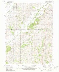
1981 Map of Blockton
USGS Topo · Published 1981About this map
The Platte River and Grand River systems define this rural landscape along the border of Iowa and Missouri. In the early 1980s, the region was characterized by small agricultural hubs like Blockton and Redding, connected by a network of country roads and the Chicago and North Western railroad line. The map highlights the evolution of regional infrastructure, noting an Old Railroad Grade and an Old RR Grade near the Ringgold County line, signaling the shifting patterns of transportation in the late 20th century. Local heritage is preserved through numerous rural landmarks, including Tent Chapel and the small settlement of Irena. Genealogists will find several burial sites such as Rosehill Cem, Fairview Cem, and Honey Grove Cem, which serve as permanent markers of the families who settled these border townships.
Find a feature on this map
23 named features on this map. Tap any name to fly to it.
Don’t see what you’re looking for? This feature index may not catch every label — zoom into the map to look around manually.
Map Details
Editions of this 1981 Blockton Map
This is the sole edition of this map. No revisions or reprints were ever made.
Other maps of this area

1940 · Blockton
USGS Topo · 1:62,500

1940 · Bedford
USGS Topo · 1:62,500

1940 · Parnell
USGS Topo · 1:62,500

1942 · Grant City
USGS Topo · 1:62,500

1943 · Bedford
USGS Topo · 1:62,500

1943 · Parnell
USGS Topo · 1:62,500

1943 · Grant City
USGS Topo · 1:62,500

1943 · Blockton
USGS Topo · 1:62,500

1955 · Nebraska City
USGS Topo · 1:250,000

1957 · Nebraska City
USGS Topo · 1:250,000