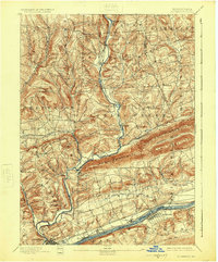
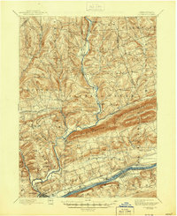
1894 Map of Bloomsburg
USGS Topo · Published 1925About this map
Fishing Creek and its major tributaries, including Huntington Creek and Little Fishing Creek, carve a complex drainage pattern through the ridge-and-valley landscape of Columbia County. The 1890 survey illustrates a period where water, rail, and canal infrastructure coexisted along the Susquehanna River. While the Pennsylvania Canal still follows the riverbank, the presence of the D. L. and W. R. R. and the Wilkesbarre and Western R.R. signifies the shifting dominance of steam power. The prominence of Knob Mountain and Lee Mountain provides a natural barrier that influenced the placement of early settlements like Orangeville and Benton. Researchers can find numerous small hamlets and milling sites, such as Coles Mills and Light Street, which were essential to the local agricultural economy before the rise of larger industrial centers.
Find a feature on this map
62 named features on this map. Tap any name to fly to it.
Don’t see what you’re looking for? This feature index may not catch every label — zoom into the map to look around manually.
Map Details
Editions of this 1894 Bloomsburg Map
6 editions found

Other maps of this area

1889 · Catawissa
USGS Topo · 1:62,500

1891 · Harveys Lake
USGS Topo · 1:62,500

1892 · Catawissa
USGS Topo · 1:62,500

1892 · Shamokin
USGS Topo · 1:62,500

1892 · Mahanoy
USGS Topo · 1:62,500

1893 · Harvey Lake
USGS Topo · 1:62,500

1893 · Shamokin
USGS Topo · 1:62,500

1893 · Mahanoy
USGS Topo · 1:62,500

1894 · Catawissa
USGS Topo · 1:62,500

1894 · Shickshinny
USGS Topo · 1:62,500