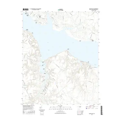
2016 Map of Blounts Bay
USGS Topo · Published 2016About this map
Blounts Bay and the wide confluence of the Pamlico River dominate this coastal Beaufort County landscape, where tidal guts and narrow creeks carve into the low-lying shoreline. Residential developments like River Acres and Shady Banks cluster along the northern banks near River Road, while the southern shore remains characterized by more dispersed settlements such as Gilead and the specialized grounds of Camp Hardee and Camp Leach.
Find a feature on this map
94 named features on this map. Tap any name to fly to it.
Don’t see what you’re looking for? This feature index may not catch every label — zoom into the map to look around manually.
Map Details
Editions of this 2016 Blounts Bay Map
This is the sole edition of this map. No revisions or reprints were ever made.
Other maps of this area

1902 · Vanceboro
USGS Topo · 1:62,500

1903 · Chocowinity
USGS Topo · 1:62,500

1904 · Vanceboro
USGS Topo · 1:62,500

1905 · Chocowinity
USGS Topo · 1:62,500

1905 · Vanceboro
USGS Topo · 1:62,500

1943 · Plymouth
USGS Topo · 1:125,000

1950 · Pinetown
USGS Topo · 1:24,000

1950 · Aurora
USGS Topo · 1:24,000

1950 · Edward
USGS Topo · 1:24,000

1951 · Bunyan
USGS Topo · 1:24,000