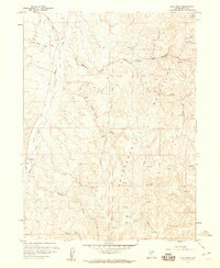
1958 Map of Blue Basin
USGS Topo · Published 1960About this map
The Independence Mountains dominate this high-altitude landscape of Elko County, Nevada, where complex drainage systems define the high desert terrain. Water resources are the primary features of interest, with numerous unnamed Springs dotting the slopes and feeding a network of named waterways including Chicken Creek, South Field Creek, and Lake Creek. These drainages often converge into larger systems like Hereford Field Maggie Creek, which winds through the western portion of the sheet. Evidence of ranching and land use is clear through the identification of specific grazing or water-rights areas such as Basco Field and Taylor Field Creek. The map is a detailed record of the mid-20th-century cattle country, marked by a system of Jeep Trails and survey markers like Vabm 7557. In the south, Blue Basin Creek flows through the area that gives the quadrangle its name, providing a focused look at the hydrology of the Great Basin during this era.
Find a feature on this map
19 named features on this map. Tap any name to fly to it.
Don’t see what you’re looking for? This feature index may not catch every label — zoom into the map to look around manually.
Map Details
Editions of this 1958 Blue Basin Map
3 editions found
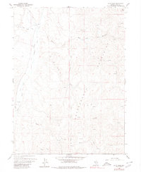
Other maps of this area

1955 · McDermitt
USGS Topo · 1:250,000

1955 · Wells
USGS Topo · 1:250,000

1955 · Winnemucca
USGS Topo · 1:250,000

1955 · Elko
USGS Topo · 1:250,000

1958 · Winnemucca
USGS Topo · 1:250,000

1958 · Wells
USGS Topo · 1:250,000

1958 · Elko
USGS Topo · 1:250,000

1958 · Singletree Creek
USGS Topo · 1:24,000

1958 · Blue Basin
USGS Topo · 1:24,000

1958 · Doby Summit
USGS Topo · 1:24,000