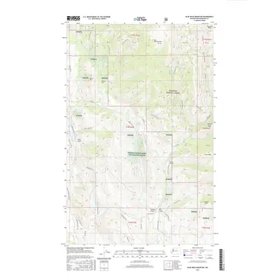
2017 Map of Blue Buck Mountain
USGS Topo · Published 2017About this map
Methow Winter Range and Wildlife Refuge occupies the central and southern portions of this landscape, reflecting a commitment to habitat preservation in the Okanogan region. The terrain is defined by a series of prominent ridges and drainages, including the height of Blue Buck Mountain and Bowen Mtn to the north. These uplands are separated by deep-cut features such as Pipestone Canyon and Wolf Canyon, which channel seasonal water toward the valley floor. Small alpine bodies of water like Cougar Lake and Lightning Lake are scattered across the high country, while Campbell Lake and Bonner Lake sit lower in the drainage basins. A complex network of Forest Service roads, including Nat For Dev Rd 200 and Lester Rd, provides access to the Okanogan National Forest, showing how the land is managed for both recreation and conservation in the modern era.
Find a feature on this map
60 named features on this map. Tap any name to fly to it.
Don’t see what you’re looking for? This feature index may not catch every label — zoom into the map to look around manually.
Map Details
Editions of this 2017 Blue Buck Mountain Map
This is the sole edition of this map. No revisions or reprints were ever made.
Other maps of this area

1899 · Methow
USGS Topo · 1:125,000

1901 · Methow
USGS Topo · 1:125,000

1905 · Okanogan
USGS Topo · 1:125,000

1906 · Chopaka
USGS Topo · 1:125,000

1954 · Okanogan
USGS Topo · 1:250,000

1955 · Concrete
USGS Topo · 1:250,000

1956 · Loup Loup
USGS Topo · 1:62,500

1956 · Tiffany Mountain
USGS Topo · 1:62,500

1958 · Concrete
USGS Topo · 1:250,000

1958 · Okanogan
USGS Topo · 1:250,000