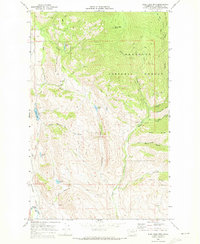
1969 Map of Blue Buck Mtn
USGS Topo · Published 1973About this map
The Okanogan National Forest dominates this 1969 survey, where the high ridges of Blue Buck Mtn and Bowen Mountain overlook a complex network of canyons and water sources. The landscape is defined by the dramatic incision of Pipestone Canyon and Fuzzy Canyon, with Beaver Creek winding through the eastern half of the quadrangle. Smaller water bodies like Cougar Lake, Campbell Lake, and Davis Lake are scattered throughout the high country, often connected by a system of pack trails and jeep trails.
Find a feature on this map
42 named features on this map. Tap any name to fly to it.
Don’t see what you’re looking for? This feature index may not catch every label — zoom into the map to look around manually.
Map Details
Editions of this 1969 Blue Buck Mtn Map
This is the sole edition of this map. No revisions or reprints were ever made.
Other maps of this area

1899 · Methow
USGS Topo · 1:125,000

1901 · Methow
USGS Topo · 1:125,000

1905 · Okanogan
USGS Topo · 1:125,000

1906 · Chopaka
USGS Topo · 1:125,000

1954 · Okanogan
USGS Topo · 1:250,000

1955 · Concrete
USGS Topo · 1:250,000

1956 · Loup Loup
USGS Topo · 1:62,500

1956 · Tiffany Mountain
USGS Topo · 1:62,500

1958 · Concrete
USGS Topo · 1:250,000

1958 · Okanogan
USGS Topo · 1:250,000