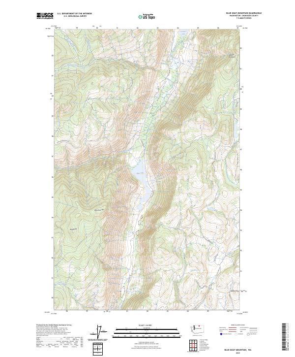
2023 Map of Blue Goat Mountain
USGS Topo · Published 2023About this map
Sinlahekin Deer Winter Range and Wildlife Refuge dominates this section of Okanogan County, preserving a corridor of critical habitat through the Sinlahekin Valley. The terrain is defined by dramatic elevation changes, rising from the waters of Blue Lake and Conners Lake to the summits of Blue Goat Mtn and Aeneas Mountain. This landscape illustrates the management of public lands for conservation and winter migration, with numerous watercourses like Wickiup Creek and Sarsapkin Creek feeding the valley floor.
Find a feature on this map
29 named features on this map. Tap any name to fly to it.
Don’t see what you’re looking for? This feature index may not catch every label — zoom into the map to look around manually.
Map Details
Editions of this 2023 Blue Goat Mountain Map
This is the sole edition of this map. No revisions or reprints were ever made.
Other maps of this area

1906 · Chopaka
USGS Topo · 1:125,000

1954 · Okanogan
USGS Topo · 1:250,000

1956 · Loomis
USGS Topo · 1:62,500

1956 · Tiffany Mountain
USGS Topo · 1:62,500

1956 · Horseshoe Basin
USGS Topo · 1:62,500

1957 · Conconully
USGS Topo · 1:62,500

1958 · Okanogan
USGS Topo · 1:250,000
1980 · Aeneas Lake
USGS Topo · 1:24,000
1980 · Blue Goat Mtn
USGS Topo · 1:24,000
1981 · Conconully East
USGS Topo · 1:24,000