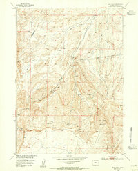
1953 Map of Blue Gulch
USGS Topo · Published 1954About this map
Beaver Rim dominates the southern landscape of this 1953 survey, creating a dramatic topographical escarpment in Fremont County. The map documents a rugged high-desert environment defined by the elevation at VABM Asbell 7241 and the prominent Blue Ridge. This area is characterized by a sparse but vital network of water sources, including Keg Spring, Cogswell Spring, and Mooney Spring, which were essential landmarks for early ranchers and travelers in this arid region.
Find a feature on this map
21 named features on this map. Tap any name to fly to it.
Don’t see what you’re looking for? This feature index may not catch every label — zoom into the map to look around manually.
Map Details
Editions of this 1953 Blue Gulch Map
3 editions found
Other maps of this area

1952 · Tin Cup Mountain
USGS Topo · 1:24,000

1952 · Double Butte
USGS Topo · 1:24,000

1952 · Rongis Reservoir
USGS Topo · 1:24,000

1953 · Blue Gulch
USGS Topo · 1:24,000

1953 · Elkhorn Springs
USGS Topo · 1:24,000

1953 · Campbell Ridge
USGS Topo · 1:24,000

1953 · Sand Draw
USGS Topo · 1:24,000

1953 · Dishpan Butte
USGS Topo · 1:24,000

1955 · Lander
USGS Topo · 1:250,000

1955 · Casper
USGS Topo · 1:250,000