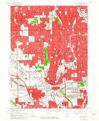
1963 Map of Blue Island
USGS Topo · Published 1965About this map
Blue Island serves as a major industrial and transit hub in the mid-1960s, defined by the convergence of the Calumet Sag Canal and a dense network of railroads including the Rock Island and Pacific and the Grand Trunk Western. The map reveals a suburban landscape in full maturity, where established communities like Evergreen Park, Oak Lawn, and Midlothian are tightly integrated with the Chicago city limits. Significant institutional presence is marked by a concentration of large cemeteries such as St Marys Cemetery and Mt Hope Cemetery, alongside educational landmarks like St Xavier College and the Morgan Park Academy. The industrial character of the southern section is further emphasized by the Little Calumet River corridor and the infrastructure of the Tri-State Tollway, documenting the era's reliance on both waterway transport and the expanding interstate system.
Find a feature on this map
126 named features on this map. Tap any name to fly to it.
Don’t see what you’re looking for? This feature index may not catch every label — zoom into the map to look around manually.
Map Details
Editions of this 1963 Blue Island Map
3 editions found
Other maps of this area

1889 · Chicago
USGS Topo · 1:62,500

1890 · Des Plaines
USGS Topo · 1:62,500

1891 · Chicago
USGS Topo · 1:62,500

1891 · Riverside
USGS Topo · 1:62,500

1892 · Calumet
USGS Topo · 1:62,500

1893 · Calumet
USGS Topo · 1:62,500

1893 · Riverside
USGS Topo · 1:62,500

1894 · Des Plaines
USGS Topo · 1:62,500

1900 · Chicago
USGS Topo · 1:62,500

1900 · Des Plaines
USGS Topo · 1:62,500