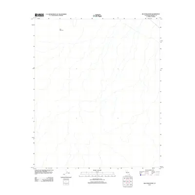
2012 Map of Blue Mountain
USGS Topo · Published 2012About this map
Blue Mountain dominates the northern reaches of this Colorado Desert landscape within Imperial County. This 2012 survey by the U.S. Geological Survey captures the intricate drainage patterns and relief of a predominantly undeveloped arid environment. The map provides an exacting record of the topography, illustrating the complex network of ephemeral washes and desert terrain that characterize this part of the California backcountry. Due to the absence of named settlements or man-made infrastructure on the sheet, the focus remains entirely on the natural landforms and the elevation contours that define this specific quadrangle.
Find a feature on this map
1 named feature on this map. Tap any name to fly to it.
Don’t see what you’re looking for? This feature index may not catch every label — zoom into the map to look around manually.
Map Details
Editions of this 2012 Blue Mountain Map
This is the sole edition of this map. No revisions or reprints were ever made.
Other maps of this area

1942 · Blythe
USGS Topo · 1:250,000

1953 · Palo Verde Mountains
USGS Topo · 1:62,500

1953 · Quartz Peak
USGS Topo · 1:62,500

1953 · Acolita
USGS Topo · 1:24,000

1953 · Chuckwalla Spring
USGS Topo · 1:62,500

1953 · Acolita
USGS Topo · 1:62,500

1954 · Salton Sea
USGS Topo · 1:250,000

1955 · Salton Sea
USGS Topo · 1:250,000

1959 · Salton Sea
USGS Topo · 1:250,000

1963 · Salton Sea
USGS Topo · 1:250,000