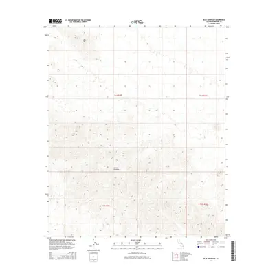
2015 Map of Blue Mountain
USGS Topo · Published 2015About this map
Chocolate Mountains dominate this arid expanse of southeastern California, where the desert floor is carved by a dense network of complex drainage washes. In the northern section of the quadrangle, Blue Mtn rises as a distinct peak amidst the rugged township lines of t11s r18e and t11s r19e. The map illustrates a landscape primarily defined by its physical geography rather than human habitation, revealing the intricate topographical contours that characterize this portion of the Colorado Desert. The absence of modern roads or settlements emphasizes the remote nature of the terrain, making this a clear record of the natural landforms as they existed in the early twenty-first century.
Find a feature on this map
6 named features on this map. Tap any name to fly to it.
Don’t see what you’re looking for? This feature index may not catch every label — zoom into the map to look around manually.
Map Details
Editions of this 2015 Blue Mountain Map
This is the sole edition of this map. No revisions or reprints were ever made.
Other maps of this area

1942 · Blythe
USGS Topo · 1:250,000

1953 · Palo Verde Mountains
USGS Topo · 1:62,500

1953 · Quartz Peak
USGS Topo · 1:62,500

1953 · Acolita
USGS Topo · 1:24,000

1953 · Chuckwalla Spring
USGS Topo · 1:62,500

1953 · Acolita
USGS Topo · 1:62,500

1954 · Salton Sea
USGS Topo · 1:250,000

1955 · Salton Sea
USGS Topo · 1:250,000

1959 · Salton Sea
USGS Topo · 1:250,000

1963 · Salton Sea
USGS Topo · 1:250,000