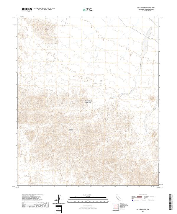
2021 Map of Blue Mountain
USGS Topo · Published 2021About this map
The Chocolate Mountains dominate this 2021 topographic profile of northeastern Imperial County, California, showing the complex landforms and dry washes that characterize this arid upland. The map centers on the high points and ridgelines of the range, including the prominent summit of Blue Mtn in the northwestern corner. Produced by the U.S. Geological Survey, this study provides a clear view of the Public Land Survey System divisions, including sections within t11s r18e, t11s r19e, t12s r18e, and t12s r19e. The absence of roads or settlements emphasizes the desert character of this terrain, where the focus remains on the precise contouring of the peaks and the natural drainage patterns of the desert floor.
Find a feature on this map
6 named features on this map. Tap any name to fly to it.
Don’t see what you’re looking for? This feature index may not catch every label — zoom into the map to look around manually.
Map Details
Editions of this 2021 Blue Mountain Map
This is the sole edition of this map. No revisions or reprints were ever made.
Other maps of this area

1942 · Blythe
USGS Topo · 1:250,000

1953 · Palo Verde Mountains
USGS Topo · 1:62,500

1953 · Quartz Peak
USGS Topo · 1:62,500

1953 · Acolita
USGS Topo · 1:24,000

1953 · Chuckwalla Spring
USGS Topo · 1:62,500

1953 · Acolita
USGS Topo · 1:62,500

1954 · Salton Sea
USGS Topo · 1:250,000

1955 · Salton Sea
USGS Topo · 1:250,000

1959 · Salton Sea
USGS Topo · 1:250,000

1963 · Salton Sea
USGS Topo · 1:250,000