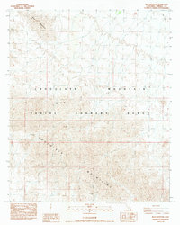
1988 Map of Blue Mountain
USGS Topo · Published 1988About this map
Chocolate Mountains dominate this 1980s landscape in Imperial County, defining a region largely shaped by military and mining activity. The expansive Aerial Gunnery Range occupies a significant portion of the terrain, indicating the area's specialized use for defense training during the late 20th century. This restricted land use is contrasted by the scattered evidence of mineral exploration, particularly at the Black Eagle Mine and the Mary Lode Mine. These sites, along with isolated labels for a Prospect, point to the enduring interest in the geological resources of the high desert. Essential water sources in this arid environment are rare, with Cottonwood Spring serving as a vital natural landmark. To the north, the elevation rises toward Blue Mountain, offering a clear view of the topographical complexity that characterizes this part of the California desert.
Find a feature on this map
10 named features on this map. Tap any name to fly to it.
Don’t see what you’re looking for? This feature index may not catch every label — zoom into the map to look around manually.
Map Details
Editions of this 1988 Blue Mountain Map
This is the sole edition of this map. No revisions or reprints were ever made.
Other maps of this area

1942 · Blythe
USGS Topo · 1:250,000

1953 · Palo Verde Mountains
USGS Topo · 1:62,500

1953 · Quartz Peak
USGS Topo · 1:62,500

1953 · Acolita
USGS Topo · 1:24,000

1953 · Chuckwalla Spring
USGS Topo · 1:62,500

1953 · Acolita
USGS Topo · 1:62,500

1954 · Salton Sea
USGS Topo · 1:250,000

1955 · Salton Sea
USGS Topo · 1:250,000

1959 · Salton Sea
USGS Topo · 1:250,000

1963 · Salton Sea
USGS Topo · 1:250,000