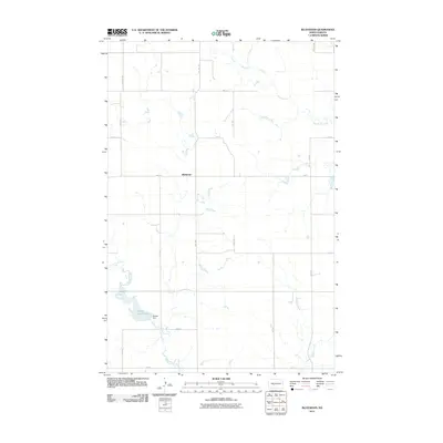
2011 Map of Bluegrass
USGS Topo · Published 2011About this map
Bluegrass occupies a central position within this part of Morton County, situated at the intersection of a vast grid of section-line roads like 32nd St and 53rd Ave SW. The landscape is defined by its drainage patterns, most notably where the impoundment at Danzig Dam creates Storm Creek Lake in the southern portion of the quadrangle. This hydraulic infrastructure suggests a managed agricultural environment, providing water storage in a region otherwise marked by the winding courses of Sweetbriar Creek, Hailstone Creek, and Muskrat Creek. The surveyor's grid is remarkably consistent here, with numbered avenues and streets like 55th Ave and 37th St providing the primary framework for movement across the prairie terrain. The map captures the quiet, dispersed nature of rural North Dakota settlement in the early 21st century.
Find a feature on this map
22 named features on this map. Tap any name to fly to it.
Don’t see what you’re looking for? This feature index may not catch every label — zoom into the map to look around manually.
Map Details
Editions of this 2011 Bluegrass Map
This is the sole edition of this map. No revisions or reprints were ever made.
Other maps of this area

1954 · Bismarck
USGS Topo · 1:250,000

1954 · McClusky
USGS Topo · 1:250,000

1958 · Bismarck
USGS Topo · 1:250,000

1958 · McClusky
USGS Topo · 1:250,000

1960 · North Almont
USGS Topo · 1:24,000

1960 · Dengate
USGS Topo · 1:24,000

1960 · New Salem
USGS Topo · 1:24,000

1970 · Bluegrass
USGS Topo · 1:24,000

1970 · New Salem NW
USGS Topo · 1:24,000

1970 · Hailstone Butte
USGS Topo · 1:24,000