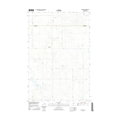
2014 Map of Bluegrass
USGS Topo · Published 2014About this map
Bluegrass serves as the central focal point of this prairie landscape, situated near the boundary line of Oliver Co Morton Co. The area is defined by a dense network of sectional roads and the meandering drainage patterns of the northern plains. Sweetbriar Cr and Muskrat Cr cut through the undulating terrain, eventually giving way to the larger Hailstone Creek system in the south. The presence of Storm Cr Lake in the southwest corner provides a significant water feature amidst the surrounding agricultural grid. This map illustrates the intersection of traditional township divisions and natural watercourses, showing how the local road network, such as 32nd St and 53rd Ave, adapts to the rolling contours of the North Dakota countryside.
Find a feature on this map
25 named features on this map. Tap any name to fly to it.
Don’t see what you’re looking for? This feature index may not catch every label — zoom into the map to look around manually.
Map Details
Editions of this 2014 Bluegrass Map
This is the sole edition of this map. No revisions or reprints were ever made.
Other maps of this area

1954 · Bismarck
USGS Topo · 1:250,000

1954 · McClusky
USGS Topo · 1:250,000

1958 · Bismarck
USGS Topo · 1:250,000

1958 · McClusky
USGS Topo · 1:250,000

1960 · North Almont
USGS Topo · 1:24,000

1960 · Dengate
USGS Topo · 1:24,000

1960 · New Salem
USGS Topo · 1:24,000

1970 · Bluegrass
USGS Topo · 1:24,000

1970 · New Salem NW
USGS Topo · 1:24,000

1970 · Hailstone Butte
USGS Topo · 1:24,000