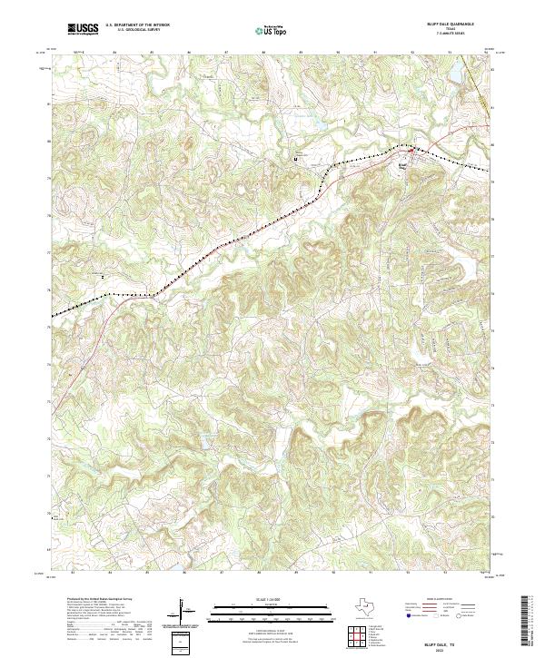
2022 Map of Bluff Dale
USGS Topo · Published 2022About this map
The community of Bluff Dale serves as the focal point of this North Texas survey, where the convergence of the N Paluxy River and S Paluxy River shapes the local topography. The landscape is defined by its drainage network, including Indian Camp Cr and Richardson Cr, with several small lakes such as Spindor Lake and Foster Lake Number 2 providing water sources across the rolling hills. Local genealogy and history are anchored by several notable burial grounds, including Wesley Chapel Cem, Acrea Cem, and the remote Pilot Knob Cem situated near the western edge of the quadrangle. Transport routes like FM 1188 and FM 2481 connect the outlying farm-to-market areas to the town center at Bluff Dale, while the county boundary between Erath Co and Hood Co is visible in the northeastern corner near Wolf Cr.
Find a feature on this map
64 named features on this map. Tap any name to fly to it.
Don’t see what you’re looking for? This feature index may not catch every label — zoom into the map to look around manually.
Map Details
Editions of this 2022 Bluff Dale Map
This is the sole edition of this map. No revisions or reprints were ever made.
Other maps of this area

1889 · Granbury
USGS Topo · 1:125,000

1890 · Stephenville
USGS Topo · 1:125,000

1920 · Stephenville
USGS Topo · 1:125,000

1931 · Tolar
USGS Topo · 1:62,500

1954 · Dallas
USGS Topo · 1:250,000

1954 · Abilene
USGS Topo · 1:250,000

1958 · Dallas
USGS Topo · 1:250,000

1958 · Abilene
USGS Topo · 1:250,000
1960 · Tolar
USGS Topo · 1:24,000

1961 · Johnsville
USGS Topo · 1:24,000