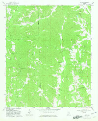
1967 Map of Bluff
USGS Topo · Published 1981About this map
The border of Lamar and Fayette Counties defines the rural landscape of this 1960s survey, centered on the community of Bluff. The terrain is deeply etched by a complex drainage system including Hells Creek, Turkey Creek, and Rocky Ford Creek, with numerous small family and church cemeteries serving as primary landmarks for genealogists. The map reveals a high density of country churches and local schools that anchored these agrarian communities during the mid-20th century.
Find a feature on this map
43 named features on this map. Tap any name to fly to it.
Don’t see what you’re looking for? This feature index may not catch every label — zoom into the map to look around manually.
Map Details
Editions of this 1967 Bluff Map
3 editions found
Other maps of this area

1953 · Birmingham
USGS Topo · 1:250,000

1953 · West Point
USGS Topo · 1:250,000

1956 · Birmingham
USGS Topo · 1:250,000

1957 · Birmingham
USGS Topo · 1:250,000

1958 · West Point
USGS Topo · 1:250,000

1963 · West Point
USGS Topo · 1:250,000

1967 · Winfield SE
USGS Topo · 1:24,000

1967 · Beaverton
USGS Topo · 1:24,000

1967 · Hightogy
USGS Topo · 1:24,000

1967 · Bluff
USGS Topo · 1:24,000