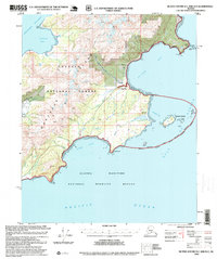
1995 Map of Blying Sound D-1 and D-2
USGS Topo · Published 1999About this map
Montague Island's southern coastline is the focus of this 1995 revision, showcasing a landscape where the Chugach National Forest meets the Alaska Maritime National Wildlife Refuge. The map details the remote coastal infrastructure of the mid-1990s, including a Communication Site and small outposts like Hanning 2 and a Resort near the western shore. The intricate hydrology of the island is well-documented, featuring the Nellie Martin River and its associated Nellie Martin River Cabin alongside the meandering Tortuous Creek.
Find a feature on this map
39 named features on this map. Tap any name to fly to it.
Don’t see what you’re looking for? This feature index may not catch every label — zoom into the map to look around manually.
Map Details
Editions of this 1995 Blying Sound D-1 and D-2 Map
This is the sole edition of this map. No revisions or reprints were ever made.
Other maps of this area

1946 · Blying Sound
USGS Topo · 1:250,000

1951 · Blying Sound
USGS Topo · 1:250,000

1951 · Seward
USGS Topo · 1:250,000

1951 · Seward A-2
USGS Topo · 1:63,360

1951 · Seward A-3
USGS Topo · 1:63,360

1951 · Blying Sound D-1 and D-2
USGS Topo · 1:63,360

1951 · Seward A-1
USGS Topo · 1:63,360

1952 · Seward A-3
USGS Topo · 1:63,360

1953 · Seward A-2
USGS Topo · 1:63,360

1953 · Seward A-1
USGS Topo · 1:63,360