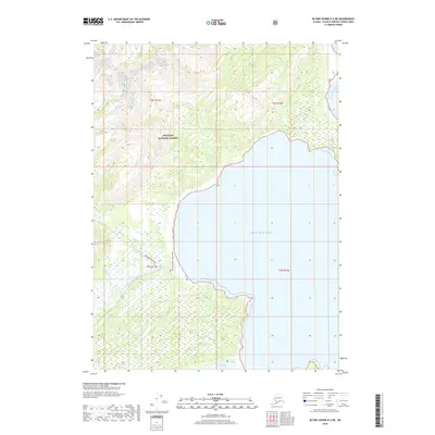
2018 Map of Blying Sound D-2 NE
USGS Topo · Published 2018About this map
The Gulf of Alaska coastline dominates this coastal survey, where the maritime environment meets the heavily glaciated and forested interior of the Chugach National Forest. The landscape is defined by its drainage patterns, most notably the Patton River and the Nellie Martin River, which flow toward the sea through a network of wetlands and tidal flats. These river systems are accompanied by established paths such as the Patton River Trail and the Nellie Martin Cabin Trail, reflecting the importance of trail-based access in this roadless portion of the Alaska-Valdez-Cordova Census Area. To the south, Stump Lake sits near the coast, while the appropriately named Braided Cr illustrates the shifting, sediment-heavy waterways characteristic of the region's alluvial plains.
Find a feature on this map
12 named features on this map. Tap any name to fly to it.
Don’t see what you’re looking for? This feature index may not catch every label — zoom into the map to look around manually.
Map Details
Editions of this 2018 Blying Sound D-2 NE Map
This is the sole edition of this map. No revisions or reprints were ever made.
Other maps of this area

1946 · Blying Sound
USGS Topo · 1:250,000

1951 · Blying Sound
USGS Topo · 1:250,000

1951 · Seward
USGS Topo · 1:250,000

1951 · Seward A-2
USGS Topo · 1:63,360

1951 · Blying Sound D-1 and D-2
USGS Topo · 1:63,360

1951 · Seward A-1
USGS Topo · 1:63,360

1953 · Seward A-2
USGS Topo · 1:63,360

1953 · Seward A-1
USGS Topo · 1:63,360
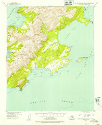
1953 · Blying Sound D-1 and D-2
USGS Topo · 1:63,360

1953 · Blying Sound
USGS Topo · 1:250,000